What's at the Bottom of Lake Erie?
Mapping our industrial, Indigenous, and geological past

When I arrived at the office of James Hall, site administrator for the Erie Maritime Museum, on a cold January morning, he was excited to show me a map in his hallway. At its bottom, in blue capital letters, it read: GHOSTSHIPS OF THE SOUTH SHORE QUADRANGLE. Above the text, I saw our portion of Lake Erie, with Ohio on the left, New York on the right, and Presque Isle's hook, dead center. Along the lake were dozens of little ship icons indicating sunken vessels – schooners, ferries, brigs, barges, steamboats, and more – peppered across the water with surprising regularity.
Upon seeing the sheer number of identified wrecks, I assumed (incorrectly) that travel by boat was extremely dangerous in the 19th century. Hall gently corrected me, "If you go back to the turn of the century or a little before that, you should imagine I-90 within five miles of the coast. Before trains, there was no way to get from point A to point B without being on the water." Back then, Lake Erie was closer to the bayfront connector than the tranquil vacation spot we enjoy today.
At the top right of the museum's map is a curious blank spot, one of the only places where this "graveyard of the Great Lakes" lacks any nautical remains. Was this area unusually safe? A road less traveled? Neither – it's simply the part we've neglected to explore.
This fall, a public/private partnership between the Ocean Exploration Cooperative Institute (part of our federal government's National Oceanic and Atmospheric Administration or NOAA), the Center for Coastal and Ocean Mapping at the University of New Hampshire, and two private companies (Louisiana's Chance Maritime Technologies and R2Sonic from Austin,Texas) began to address that problem by examining the northeast corner of Pennsylvania's portion of Lake Erie in greater detail than ever before. It's not some tiny periphery they're looking at, either. The project has mapped about 98 square miles of lakebed along the Pennsylvania, New York, and Canadian borders – a survey area about five times larger than the City of Erie itself. According to Honey Stempka, NOAA's Lake Erie designation manager, the work is long overdue in our region: "Some of Erie's bathymetry maps were created in the 1940s and haven't been updated since then."
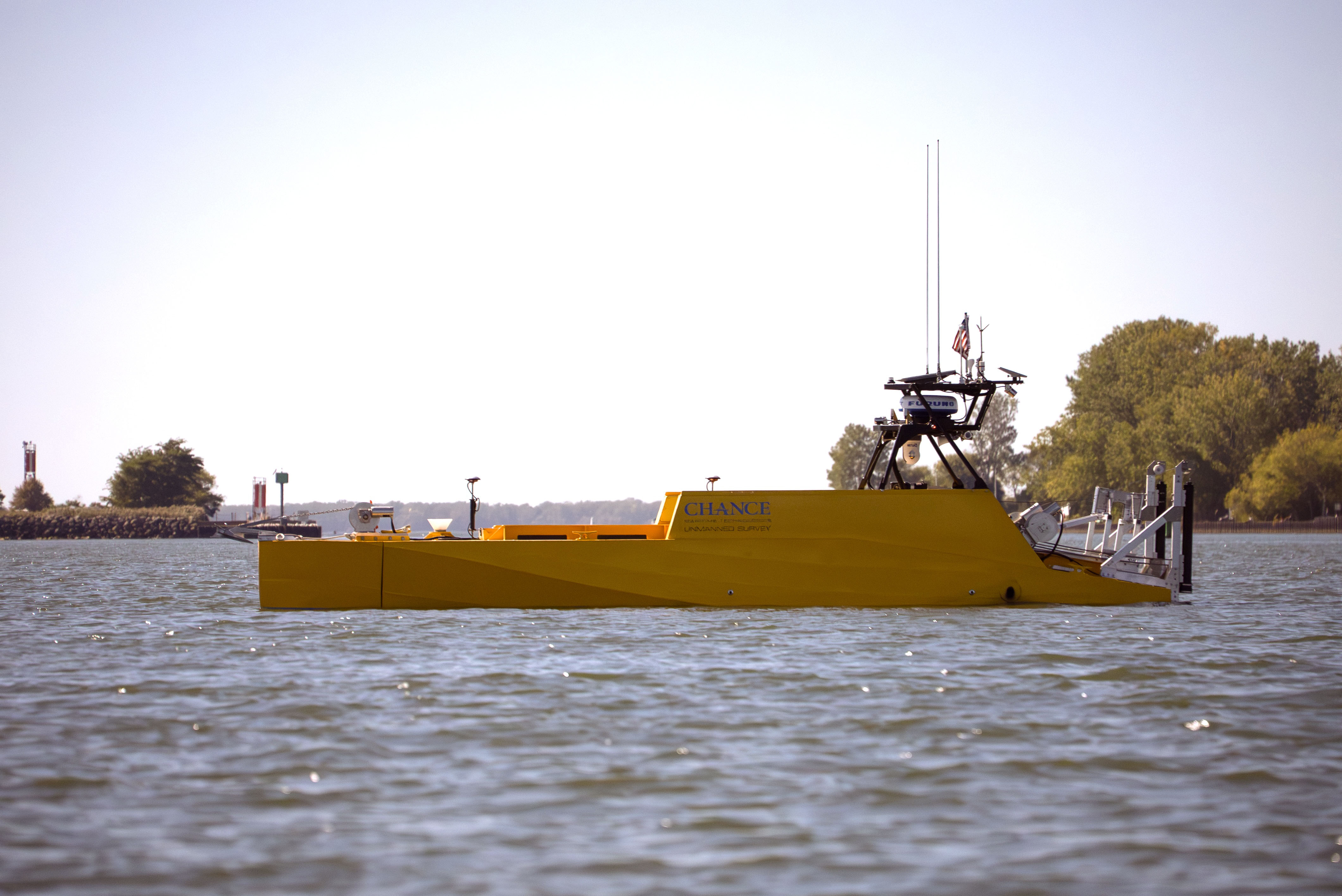 Pictured is the LR30-UV, designed by Chance Maritime Technologies, which aided in mapping about 98 square miles of lakebed along the Pennsylvania, New York, and Canadian borders this fall. (Contributed photo)
In October, a 30-foot-long, remotely operated, uncrewed vehicle called the LR-30 (designed by Chance Maritime Technologies) was sent out to explore the lakebed. Operating like some futuristic hybrid of a submarine, a Roomba, and a Zamboni, the "vessel was sent as far as 27 nautical miles off shore, and operated from a remote station set up at the Erie Maritime Museum," according to Val Schmidt of the Center for Coastal and Ocean Mapping at the University of New Hampshire. "This kind of technology is brand new and is quickly changing the way ocean mapping and exploration is done at great savings," according to the researcher. Working alongside the vessel is the Voxometer, a state-of-the-art sonar survey system designed by R2Sonic, to provide high-resolution data. It's a very symbiotic public/private partnership – two tech companies get to test their new products while Erieites get a unique look at our submerged history.
This brings us to the fun part: what are they going to find down there? The obvious answer is shipwrecks, and they've already given us a high-res map of a noteworthy one. The Howard S. Gerkin, which was built in 1910 and sank in 1926, served as an early guinea pig for their mapping technology. We now have a much clearer view of the remains of the 241-foot-long steamer. "I think people have a natural interest in shipwrecks," says Ben Ford, historic and maritime archaeologist at the Indiana University of Pennsylvania. "They represent moments of extreme drama and remind us of the larger forces around us. The ships are also part of many people's heritage, representing how their families came to the region or past occupations."
Val Schmidt is especially excited about what we might learn about the history of our industries: "Lake Erie, as a major commercial waterway, was critical to early industry and exploration. Folks from the local fisheries office told us that, due to its shallow lakebed, Lake Erie was an extremely prolific fishery far exceeding that of the other Great Lakes and that Erie was the center of much of that fishery for many years. Much of that history still lies on the lakebed, in the form of shipwrecks and debris."
The mapping project may also inform our understanding of our prehistoric and Indigenous past. Due to changes in topography over 5,000 years ago, researchers have reason to believe that parts of the lake may have once been dry and inhabited. "The lakebed off of Erie contains a ridge that extends from Canada to within a few miles of the Pennsylvania shore," according to Ford. "This ridge separated a lake in the eastern basin from a lake in the central basin. There would have been a stream connecting the two lakes running near the PA shore. This would have been an attractive area to live, with varying topography and a mix of lake and river environments. It is the kind of setting that I would expect to find sites if it was dry land. It's a pretty unique setting in Lake Erie and the Great Lakes in general."
%20copy.jpg)
This graphic shows an example of what is recorded with the current underwater mapping technology – this is a high-res scan of the Howard S. Gerkin shipwreck. (Contributed)
Ford is careful to note that more work must be done in this regard, and that any inquiry into our Indigenous past must be done in cooperation with Indigenous leaders. "Native American scholars and elders have the best understanding of how their ancestors likely used these spaces," explains Ford. "Archaeologists can help reconstruct the landscape – find places that have intact surfaces – and ask questions based on our understanding of the past, but Indigenous knowledge and understanding of how these spaces were likely used is really key. If we can find early settlements, they will significantly increase the database about how ancestors made a living – what plants, animals, and resources they used. If they were living near the lakes, were reeds, fish, and different medicines more prevalent than we currently understand from what would have been upland settlements? Was life organized differently in the settlements near the paleolakes? Can these now-submerged settlements shed new light on Indigenous histories by linking them to places and events?" Only time will tell, but we may soon have some answers.
For the non-history buffs among us, the mapping project may have a more practical impact, according to James Hall of the Maritime Museum: "I'll tell you what the public in Erie is most interested in – fishing spots. I can't tell you how many Facebook comments, emails, and telephone comments we get asking when all this stuff will be released. They want to know where the fish are!" Since a lot of the lake is composed of silt and devoid of life, shipwrecks "provide a place for small animals to hide – and the big animals come to eat the smaller ones," according to Hall. When the project's data is eventually released, you might end up re-routing your weekend fishing trip in response to it.
In the meantime, we have to wait. "Our data collection effort was hugely successful and with that comes a mountain of data processing and documentation to ensure the data is immediately useful to others," explains Schmidt. However, after working with NOAA and the State of Pennsylvania, the data will eventually become publicly available. "The people who read the Erie Reader are living here because of the lake," says James Hall. "If you work at Hamot, you know that there wouldn't be a hospital here if there weren't a city, and there wouldn't be a city without the lake." Whether you're a student of history in search of new artifacts or an angler in search of yellow perch, this data will be sure to make our local environment more fascinating and intimate.
The Lake Erie mapping project is part of a larger project, sponsored by NOAA, titled Lakebed 2030. The project aims to fully map all five of our Great Lakes over the next four years. Visit glos.org/lakebed-2030/ for more info.
Dan Schank can be contacted at danschank@gmail.com